A note for future lejog people, once you turn off the main road after Tintern, the wee roads are somewhat confusing. i missed the first turnoff because it looked like someone’s driveway. Then i got very confused as to where i was and had to plump for carrying on up and down hills in the hope i’d hit the main b road. which, i eventually did.
Turns out, Google Maps satellite view is great for revisiting and analysing your mistakes!
Month: May 2009
The best laid plans
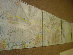
Due north for the next 5 map pages!
I’ve reworked my plans a bit. Partly to get to places on days when my family can make it along for meetups, but mostly because the longer days i’d planned for the next few stages just don’t look sane given my typical days so far. And of course, who knows what the weather will do! So, here’s the revised plan.
Sat, Ross on Wye to Much Wenlock.
Sun, to Middlewich
Mon, to Whalley
Tue, to Kendal
Wed, to Gretna
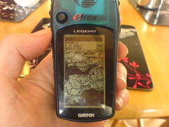
I dug around on the gps last night and found that its route point memory is full with 10 routes containing 50 points. I’m sure the internet said it stored 20 routes and 50 points. Regardless, shame on me for not verifying. Still, i’m very glad i bought a good waterproof map case, because it means i can bungee it to the bike rack and check it fairly easily. Not as good as a bar bag, but i didn’t want one of them – another bag to lug, no space on bars anyway. It’s been rained on lots, and maps are still dry. Still miss the gps a lot, though it’s still been a big help even just in track mode.
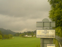
Another day, another county
Made it to the bnb in Ross on Wye. Of course, the moment i stopped, the rain stopped too, grr. Psychologically, i’m a bit frustrated about the weather-based change of plan. I feel fine, and could do many more miles today but after yesterdays soaking, and similar downpours today near Tintern, i need to dry out. On one hand, i tell myself that it’ll be good to have a half days rest. But on the other hand, i don’t really need or want a rest stop. I’ve cycled nearly 300 miles in the last 4.5 days, but energywise i’ve been in a pretty steady state since day one. Still, i’m glad i left Chepstow and did at least some distance today – only 30 miles but that’s 30 more miles done regardless.
Tintern
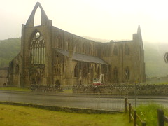
Tintern Abbey, in the wet. At Coleford now. Booked bnb in ross on wye so short day today. 13m to go.
From yesterday

The severn bridge, in awful weather yesterday. I followed the signs of the cycle path over the bridge which somehow took me to the path on the faraway west side, as opposed to the east side i approached from. On the other side, it’s not at all obvious where to go. It’s all motorway and fast roads, much like the forth bridge.
What else happened yesterday? I thought i’d make much better progress without big hills, but the weather and some wrong turnings put paid to that. On my ride to work i do maybe 14mph average. On long but non stop training rides it was 12mph or 9mph against a strong gale. But, including meal stops, and many navigation stops i’m managing about 7.5mph overall. When i’m moving, the average speed is about 10.5. But all the stops add up in a big way.
Ho hum, downpour has finished. I’m going to wait for a bit to let the water drain a bit and see how things look.
Can’t rain all the time?
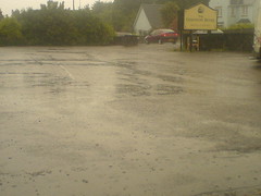
Was just about to leave when the light drizzle turned into a full on downpour. I’m currently sitting under a sun parasol thing (the irony!) outside the hotel waiting to see if it’s going to subside at all. Sigh.
Plan
Just watched forecast. Not good generally. More excitingly, it turns out there was a severe weather warning issued today for the area i cycled through. Not having much luck with the old british weather. Anyhow, provisioak revised plan for tomorrow is to get up early, verify the forecasts claim of a mostly dry morning in this specific area, and then dart 30m up the road to ross on wye. Might have to stay put there if the weather is bad.
Begone Bristol
Bristol is not my favourite place. Today it rained since noon until i arrived at 6pm. All my riding clothes are soaked. Will look at forecast and see if it’s sane to ride tomorrow. I have a towel rail, a hairdryer and some towels to work a dehydration miracle with.
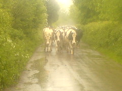
Ah, the photo. After hours in the rain, several wrong turning, too much busy bristol traffic and one close shave with a van, i wasn’t in the best of moods. The directions said ‘turn into the northward lane’. When i did, i was met with this sight blocking the road. I had to laugh.
Cheddar gorge
Prob the photo is rotated, still haven’t figured fix for that! After the first 3 days, Cheddar gorge seemed more like a gentle incline! The first two corners were steeper but the rest was a spinning slope up to about 220m. It was like some kind of ‘well done, you passed the test’ thing. 🙂 i’m having lunch in chew magna. Not long since 2nd breakfast, but places stop serving at 2 so i need to refuel before then. Target tonight is the Severn Bridge and Chepstow.
Epic gps fail
I don’t know why, but it appears that the routes i have on my gps for day 4 to day 7 are just copies of day 3’s route. I meant to verify each and every route once i’d put it onto the gps but ran out of time. It’s not the end of the world. I still have my road map, plus google maps on my phone. But it is a big pain.
I’m in Cheddar just now having food before the climb up the gorge. Much flatter today as promised, and i’ve been whizzing along at 18mph or so.